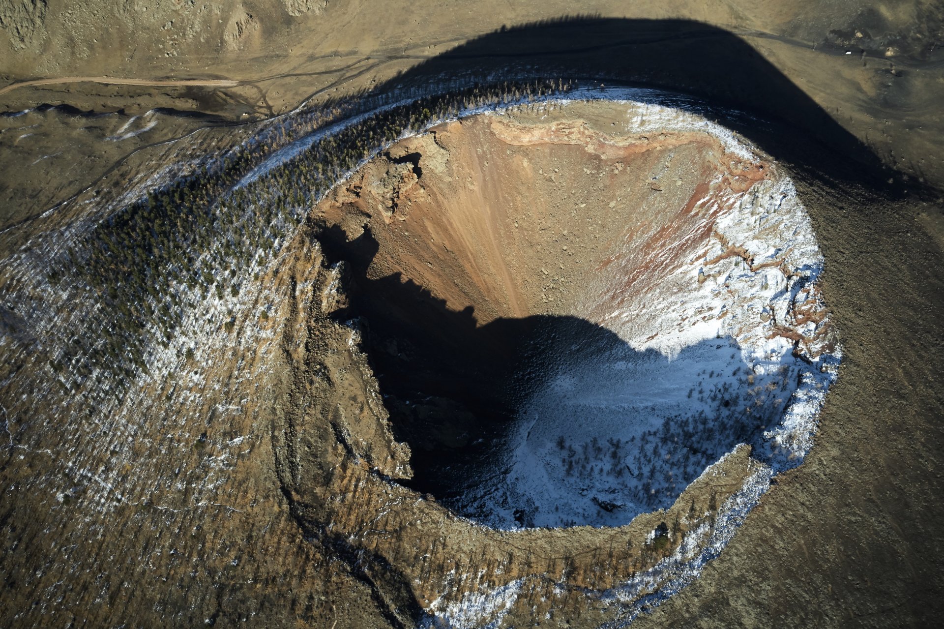
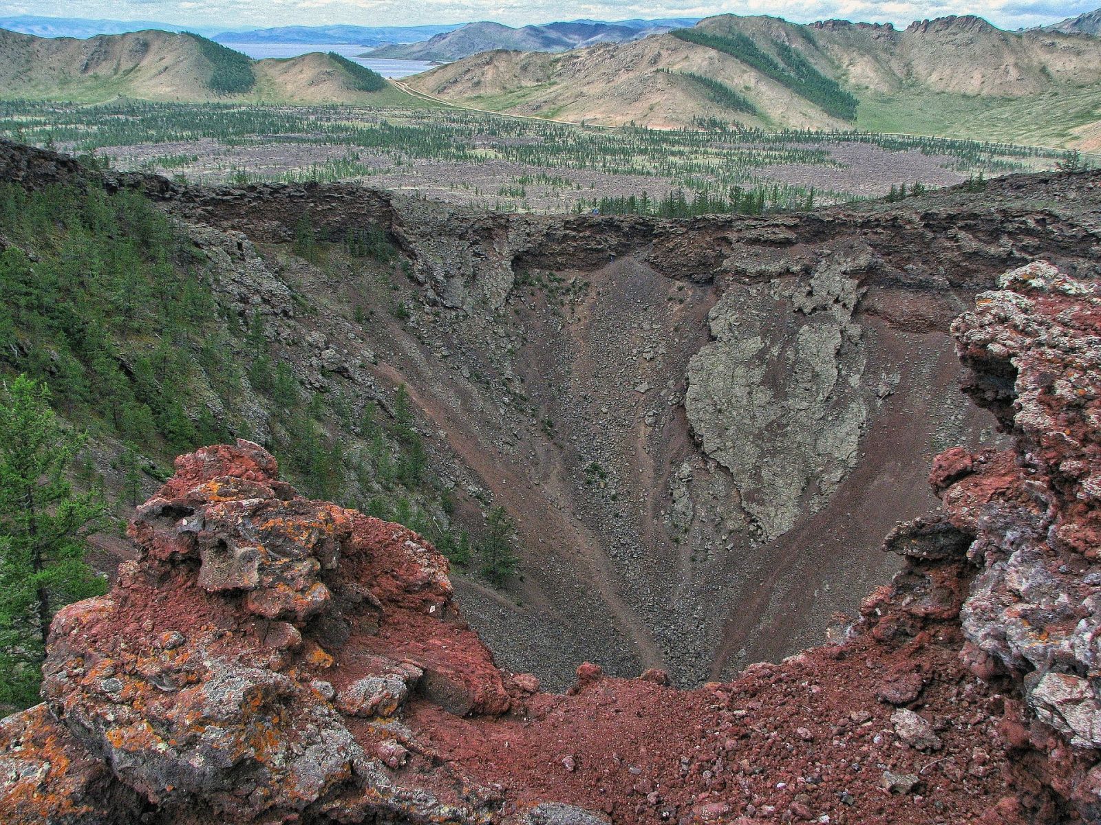
Khorgyn Togoo/ Crater of Khorgo/ or Khorgo extinct volcano is situated on the shores of Terkhiin Tsagaan Lake, a late extinct volcano that erupted 8,000 years ago. 2,210 meters above sea level, the cliffs, ravines, and gorges around Khorgo are amazing, and there are many places to hide, such as caves and depressions. At the northernmost point is the Khorgyn Togoo, which is 200 meters across, 70-80 meters deep, and has a slope of 30-36 degrees. It grows in cedar and larch forests on the back and rim, and its flowers and fruits are abundant.
In addition to Khorgyn pot, there are 33 volcanoes such as Gichgen's west and east pot, Uliin pot, Tsagaan mountain, Zalaa tolgoi, Mandly pot, and Shavryn tsaram. Among them, the Suman, Gichgene, and Chuluut rivers are bubbling and flowing at high speeds, becoming a wonderful decoration of the Khorgyn Togoo region. The scenic area was protected in 1965.
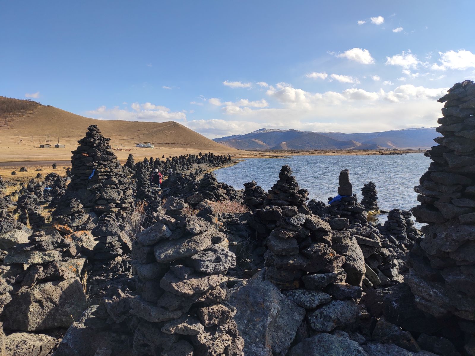
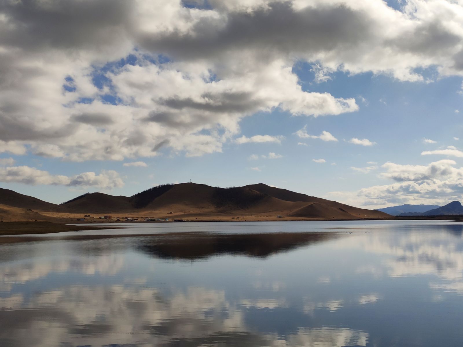
Terkhiin Tsagaan Lake: It is located in Tariat soum of Arkhangai aimag near Khorgyn Togoo. A freshwater lake formed by the the volcanic eruption, a tributary of the Terkhiin River that originates in the Khangai Mountains. It is 16 kilometers long, 6 kilometers wide, and covers an area of 61 square kilometers. It is 20 meters deep and 2060 meters above sea level. There are more than 10 rivers flowing into this lake, the largest of which is the Terkhiin river. The only river that flows out is the Suman River. It flows for about 50 kilometers and flows into the Chuluut River. On a small island in the middle of the lake, birds build their nests and lay their eggs. Cormorants come to the lake and dive to a depth of 5 meters and feed on fish.
It is a great place for fishing.